February 04, 2025
by
Early in the morning of 4 October 2023 I received a Whatsapp message from my good friend Praful Rao, who writes the amazing Save the Hills blog, which seeks to raise awareness of slope hazards in the Darjeeling-Sikkim Himalaya of northern India. Praful highlighted that an extraordinary flood had swept down the Teesta Valley, causing high levels of damage and many deaths. Such catastrophic floods are rare, especially out of the main monsoon season.
It quickly became apparent that this was no ordinary flood, and that the origin was a glacial lake located high up in snowy Himalayan peaks. Such deluges, known as Glacial Lake Outburst Floods (or GLOFs) are a serious hazard in high mountain areas. As a glacier retreats it can leave behind a bank of moraine that traps the meltwater, forming a lake. Sometimes, this water is released suddenly and catastrophically, creating a devastating GLOF. There was little doubt from an early stage that the Teesta valley event was such a GLOF.
But understanding precisely what happened is a key to understanding future risks. In the aftermath of such disasters, there is often misreporting and mythology, and there can also be a flurry of scientific articles that lack rigour. A classic example is the 2021 Chamoli disaster, which we demonstrated beyond doubt was a rock and ice avalanche, but is still termed a GLOF or a glacier collapse by many (see here for example).
So step forward the amazing Dr Ashim Sattar of IIT Bhubaneswar, who convened and managed a large multidisciplinary of scientists from around the world to analyse this event in detail and with rigour. The outcome is a paper (Sattar et al. 2025 – for transparency, I am a co-author) published today in the journal Science. It is a remarkable piece of work, providing a detailed and definitive account of the events that day.
The team has shown that the events started with a landslide on the flanks of South Lonak Lake (SLL), located at the head of the valley at [27.9125, 88.1964]. This failure involved 14.7 million cubic metres of frozen moraine – seismic data shows that this occurred at 22:13:20 local time on 3 October 2023. The slope had been moving for years before the final collapse, and there is good evidence that warming had led to degradation of the permafrost on this slope in the months leading up to the collapse. But there is no evidence that a cloudburst triggered the failure (as some have claimed) – there was some rainfall around the time of the collapse, but this was not exceptional. However, the downstream impacts were amplified by intense rainfall in West Bengal and Bangladesh.
The mass that fell into SLL generated a tsunami in the lake that was about 20 metres high. It overtopped the moraine dam, rapidly creating a major breach that released 50 million cubic metes of water (enough to fill about 20,000 Olympic swimming pools).
The images below show before and after for SLL – the black circles are the area of moraine that formed the landslide, whilst the yellow circle shows the moraine dam breach. Note the water remaining in SLL even after the GLOF.

Sattar et al. (2025) have modelled the flow of water down the Teesta River, using observational data as a benchmark. It swept downstream over the next few hours. About 1 km downstream the flood had a peak height of about 11 metres. It struck Chungthang, the location of the Teesta-III hydroelectric dam, at about 00:30 local time on 4 October 2023. The 60 m high dam was destroyed.
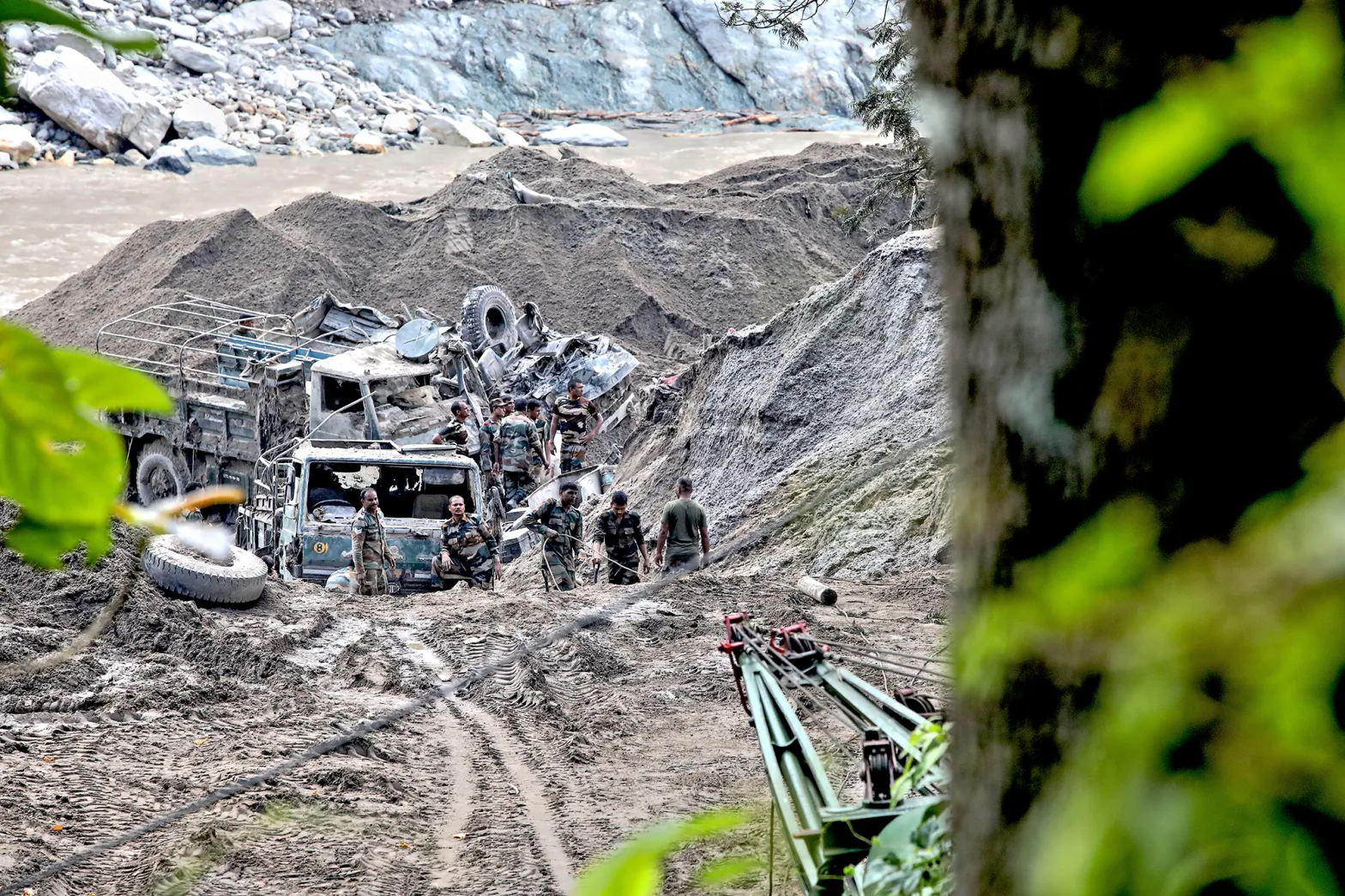
The GLOF eroded sediment and collected water on its way downstream, ultimately mobilising about 270 million cubic metres of debris. The flood caused damage that extended over a distance of 385 km, killing 129 people (55 confirmed dead, 74 missing).
Praful Rao documented the destruction in a series of blog posts – summarised here and here. It triggered 45 landslides on the flanks of the Teesta Valley, and more have happened since. Sattar et al. (2025) estimate that about 25,900 buildings were damaged, 276 square kilometres of agricultural land was inundated and 31 major bridges were damaged. Four dams were directly impacted, and there were extensive losses of livestock. Of course, the effects of this disaster will impact the landscape and its inhabitants for years or even decades to come.

SLL has not fully drained, and deformation of the moraine is continuing on the flanks of the lake. Thus, a direct repeat event cannot be ruled out, and there are thousands of similar lakes across the region. As warming continues, and it is rapid in high mountains like this, the threat from GLOFs will grow. It is only a matter of time until the next event, but we cannot say where or when. Unfortunately, the origins of these cascading hazards are remote and hard to monitor. Visiting them is bemusing – you simply cannot imagine the threat they pose.
Sattar et al. (2025) highlight the need for early warning systems; for mechanisms of risk management and mitigation; for research; and for evaluation of the risks to the growing number of hydropower schemes in this area. There is an urgency to this work, but of course many developing countries are facing reductions in aid.
Finally, I want to pay tribute to Ashim Sattar, and the wider team. This is an extraordinary collaboration that has resulted on a fantastic piece of research. We now understand this disaster, and its massive implications for other sites in high mountain areas. It is a step to making such environments safer.
Reference
Satter, A. et al. 2025. The Sikkim flood of October 2023: Drivers, causes and
impacts of a multihazard cascade. Science. doi: 10.1126/science.ads2659.
Our new paper in the journal Science provides a detailed analysis of the causes and consequences of the terrible landslide-triggered Glacial lake outburst flood (GLOF) that struck northern India late in 2023.
The Landslide Blog is written by Dave Petley, who is widely recognized as a world leader in the study and management of landslides.


